non così difficile
Toscolano
v3 a3 III
2h20
0min
1h30
50min
290m
150m
140m
15m
1x30m/1x20m
6
2500m
Auto facoltativa
Valutazione:
★★★★★
3.7 (3)
Info:
★★★
1 (1)
Belay:
★★★
3 (1)
Sintesi:
traduzione alternativa
➜
Lingua originale
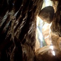
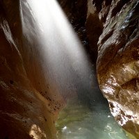
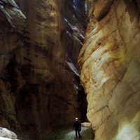
Bezaubernde tief eingeschnittene Kalkschlucht mit engen höhlenartigen Abschnitten; engste Stelle ca. 50cm breit; sauberes Wasser; gut eingerichtet (meistens Stände auf beide Seiten); Stausee im Oberlauf; Wasserableitung am Anfang der Tour; Kombination mit Campiglio möglich (Ganztagestour). Der Zustiegsweg (schlecht asphaltierte Bergstraße mit Fahrverbot) für die Campiglio (2 Std.) ist bei der Einstiegsbrücke der Toscolano; schönster Lichteinfall Vormittag/Mittag; sehr gefährlich bei Hochwasser (Wettersituation beachten!).
Charming deep lime canyon with narrow cave-like parts; narrowest part about 50cm wide; clean water; well equipped (mostly stands on both sides); reservoir in the upper reaches; water drainage at the beginning of the tour; combination with Campiglio possible (full day tour). The access path (poorly paved mountain road with driving ban) for Campiglio (2 hrs.) is at the Toscolano entrance bridge; most beautiful light morning/midday; very dangerous at high water (pay attention to weather situation!).
maggio - ottobre
10-13 Ore
Sud
Calcare
28.80km²
Sintesi:
traduzione alternativa
➜
Lingua originale
Bezaubernde tief eingeschnittene Kalkschlucht mit engen höhlenartigen Abschnitten; engste Stelle ca. 50cm breit; sauberes Wasser; gut eingerichtet (meistens Stände auf beide Seiten); Stausee im Oberlauf; Wasserableitung am Anfang der Tour; Kombination mit Campiglio möglich (Ganztagestour). Der Zustiegsweg (schlecht asphaltierte Bergstraße mit Fahrverbot) für die Campiglio (2 Std.) ist bei der Einstiegsbrücke der Toscolano; schönster Lichteinfall Vormittag/Mittag; sehr gefährlich bei Hochwasser (Wettersituation beachten!).
Charming deep lime canyon with narrow cave-like parts; narrowest part about 50cm wide; clean water; well equipped (mostly stands on both sides); reservoir in the upper reaches; water drainage at the beginning of the tour; combination with Campiglio possible (full day tour). The access path (poorly paved mountain road with driving ban) for Campiglio (2 hrs.) is at the Toscolano entrance bridge; most beautiful light morning/midday; very dangerous at high water (pay attention to weather situation!).
Accesso:
traduzione alternativa
➜
Lingua originale
Von Torbole fährt man auf der „SS45“ durch Riva und am westlichen Ufer entlang bis zur Ortschaft Toscolano Maderno. In Toscolano biegt man rechts Richtung Gaino ab.
Um das Überstellungsfahrzeug zu parken zunächst nicht rechts (hinauf) nach Gaino, sondern man folgt der schmalen Aspahlt- Straße/Schotterstraße mit der Beschilderung "Riserva di Pesca". Die Straße führt in das Valle de Cartiere wo man den ersten PKW vor dem Fahrverbotsschild am großen Parkplatz parkt.
Mit dem zweiten PKW fährt man wieder zurück zur Gabelung und dann links hinauf nach Gaino. Vor der Ortschaft folgt man dem weißen Schild „Gaino“ zuerst rechts dann links. Die schmale Hauptstraße führt direkt in den Ort. Hier kurz rechts (sehr schmale Durchfahrt, max 2.10m), dann gleicher wieder links Richtung „Rif. Pirlo“/“San Lorenzo“. Danach folgt man der anfangs noch asphaltierten Hauptstraße neben der Schlucht für ca. 5Km bis zu einem Kraftwerkshäuschen mit grünem Zaun. Parkmöglichkeit vor dem Schranken (links).
Bemerkung: Die Tour kann auch mit einem PKW gemacht werden. Dafür muss man aber den Ausstiegsweg noch erkunden (wir fanden aber die Variante über den historischen Weg lohnenswerter).
From Torbole take the "SS45" through Riva and along the western shore to the village of Toscolano Maderno. In Toscolano turn right towards Gaino.
To park the shuttle car, do not turn right (up) to Gaino, but follow the narrow asphalt/gravel road marked "Riserva di Pesca". The road leads to the Valle de Cartiere where you park the first car in front of the no driving sign at the large parking lot.
With the second car, go back to the fork and then turn left up to Gaino. Before entering the village, follow the white signs for Gaino, first to the right and then to the left. The narrow main road leads directly into the village. Here turn right (very narrow passage, max 2.10m), then immediately left again towards "Rif. Pirlo"/"San Lorenzo". Then follow the main road, which is still asphalted at the beginning, next to the canyon for about 5 km until you reach a power station with a green fence. Parking is possible in front of the barrier (on the left).
Note: The tour can also be done by car. For this, however, you still have to explore the exit path (but we found the variant via the historic path more rewarding).
Avvicinamento (0 min):
traduzione alternativa
➜
Lingua originale
Vom Parkplatz beim Schranken über den Schotterweg, direkt in den Bach absteigen.
From the parking lot by the barrier, descend via the gravel path, directly into the stream.
Giro (1 h 30):
traduzione alternativa
➜
Lingua originale
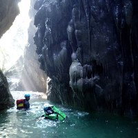
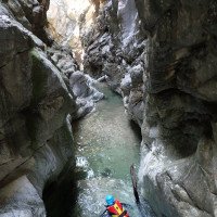
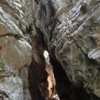
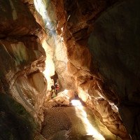
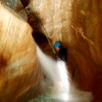
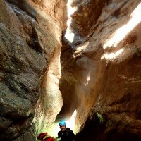
Der Torrente Toscolano ist, bis auf die kleinen Abseilstellen (max. 15m) die im beeindruckenden tief eingeschnittenen Teil der Schlucht sind, ein Wandercanyon mit einigen Abkletterstellen. Die Schlucht beginnt unspektakulär, wandernd und abkletternd passiert man eine Wasserableitung und kurz darauf eine weitere Wasserverbauung (evtl. auch hier Einstiegsmöglichkeit). Nach ca. 15min. und einem kleinen Blockgelände verengt sich die Schlucht. Nun folgt der schönste Abschnitt. Mehrere kleine Stufen führen in die immer enger und schöner werdende Schlucht. An fast allen Stufen gibt es zwei Standplätze. Einige Stellen können auch abgeklettert oder nach Kontrolle gesprungen werden. Um den schönsten Eindruck zu gewinnen sollte die Tour bei Schönwetter und vor der Mittagszeit (Lichteinfall) mit etwas Wasserdurchlauf gemacht werden. Bei Schlechtwetter sollte die Schlucht auf keinen Fall begangen werden, da die engste Stelle gerade Mal 50cm breit ist und ein plötzlicher Wasseranstieg lebensgefährlich wäre! Zusätzlich gibt es im Oberlauf einen großen Stausee (Lago di Valvestino“) mit Automatik-Wehranlage. Am Schluss der Engklamm (bei den Wassereinleitungen) gibt es noch schöne Versinterungen bevor sich die Schlucht öffnet. Nach dem Geröllfeld bleibt man am besten im Bachbett da sich ein Ausstieg über den alten Steig neben der Schlucht nicht lohnt. Nach ca. 20min. erreicht man beim Haus „ Campo Scout“ auf ca. 150m den Ausstieg aus dem Bach.
The Torrente Toscolano is, except for the small rappels (max. 15m) that are in the impressive deep cut part of the canyon, a hiking canyon with some downclimbs. The canyon begins unspectacularly, hiking and abseiling you pass a water drainage and shortly after another water obstruction (possibly also entry possibility here). After about 15min. and a small block terrain, the canyon narrows. Now follows the most beautiful part. Several small steps lead into the canyon, which becomes narrower and more beautiful. At almost all steps there are two places to stand. Some places can also be downclimbed or jumped after control. In order to get the most beautiful impression, the tour should be done in good weather and before noon (light incidence) with some water flowing through. In case of bad weather, the canyon should not be visited, because the narrowest part is just 50cm wide and a sudden rise of water would be life-threatening! In addition, in the upper reaches there is a large reservoir ("Lago di Valvestino") with automatic weir. At the end of the gorge (at the water intakes) there are still beautiful sinterings before the canyon opens. After the boulder field it is best to stay in the streambed as it is not worth to exit via the old path next to the canyon. After about 20min. you reach the exit from the stream at the house "Campo Scout" at about 150m.
Ritorno (50 min):
traduzione alternativa
➜
Lingua originale
Ab dem Haus („Campo Scout“)folgt man der Forststraße bzw. dem Wanderweg neben dem Bach, durch das Papiermühlental (1870er). Wer möchte kann bei der Bar „Al Museo“ noch einen Einkehrschwung machen bevor es zum zweiten PKW am unteren Parkplatz geht. (Achtung! Fischzucht im Unterlauf, daher besser auf den Wanderweg ausweichen).
From the house ("Campo Scout")follow the forest road or the trail next to the stream, through the paper mill valley (1870s). If you want you can stop at the bar "Al Museo" before going to the second car at the lower parking lot. (Attention! Fish farm in the lower stream, so it is better to take the hiking trail).
Coordinate:
Inizio del canyon
(cwiki_1)
Parcheggio all'entrata
Straße gesperrt. Zustieg von unten zu Fuß. Einstiegsparkplatz bei der alten Brücke bei 'Le Camerate' (cwiki)
Parcheggio in uscita
Ausstiegsparkplatz im Valle delle Cartiere (cwiki)
Parcheggio in uscita
Parkmöglichkeit bei Strasse zu Wehr (cwiki)
Fine del canyon
(cwiki_1)
Info sul canyon ACA
Info sul canyon Cwiki
Info sul canyon Descente
Altro info sul canyon
Altro info sul canyon
08.08.2023
Mazzoldi
⭐
★★★★★
📖
★★★
⚓
★★★
Completato ✔
traduzione alternativa
➜
Lingua originale
Non più praticabile perchè completamente invasa dalla frana la parte più bella della forra. Interdetto da ordinanza del sindaco
No longer practicable because completely overrun by landslide the most beautiful part of the gorge. Interdicted by order of the mayor
20.07.2023
Bernhard
⭐
★★★★★
📖
★★★
⚓
★★★
💧
Basso
Completato ✔
traduzione alternativa
➜
Lingua originale
Wir sind anscheinend zu niedrig bei der Kurve mit dem großen Versturz eingestiegen . Jedenfalls so nur kurz 2 abseiler und die schöne Einzelstelle. Würd ich nur machen wenn man schon in der Nähe ist
Oberer Parkplatz nicht mehr möglich da die Straße im oberen Drittel gesperrt ist und vermutlich bleibt
We are apparently too low at the bend with the big fall entered . Anyway, so only short 2 abseiler and the beautiful single place. I would only do if you are already in the area
Upper parking lot no longer possible because the road in the upper third is closed and probably remains
09.03.2023
System User
⭐
★★★★★
📖
★★★
⚓
★★★
nessuna traduzione disponibile
Info: Teile der Canyonbeschreibung wurden automatisiert übernommen. Konkret die Felder Weblinks, Koordinaten, Rating, Ort, Länge des Canyon, Einfachseil Mindestens von https://canyon.carto.net/cwiki/bin/view/Canyons/ToscolanoCanyon.html und https://www.descente-canyon.com/canyoning/canyon/23768
09.03.2023
System User
⭐
★★★★★
📖
★★★
⚓
★★★
nessuna traduzione disponibile
Daten importiert von https://www.canyoning.or.at/index.php/liste-aller-canyons/424-toscolano
Nuovo rapporto
Riportare brevemente e concisamente le informazioni più importanti dell'ultimo tour o importanti informazioni attuali sul canyon. Se necessario con link a video, foto, ecc..
*
*
*
Esc
Del
Idrologia:

