v4 a2 III
0min
0min
0min
0min
1625m
980m
645m
33m
2x40
19
2300m
Auto necessaria
Valutazione:
★★★★★
2.9 (2)
Info:
★★★
0 ()
Belay:
★★★
0 ()
Sintesi:
traduzione alternativa
➜
Lingua originale
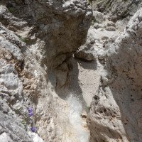
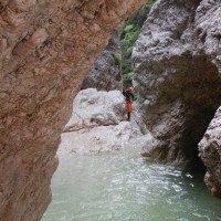
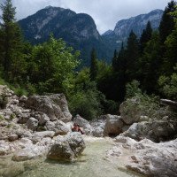
Sehr schöne kurzweilige Schlucht im typischen vertikalen alpinen Gelände der julischen Alpen. Der weiche Kalk in diesem Gebiet führt zu einem wunderschönen Berg- und Schluchtambiente. Weißer Kalk und blaue Gumpen und 19 gut eingerichtete Abseilstellen machen die Schlucht für Freunde von alpinen Schluchten zum Genuss. Teilweise kann der Torto durchaus herausfordernd werden wenn der Wasserstand höher ist, da einige Abseilstellen zwingend im gebündelten Wasser verlaufen. Auf Grund des weichen Gesteins und durch die eher geringe Begehungsfrequenz des Rio Tortos, sollte immer das Notbohrset dabei sein.
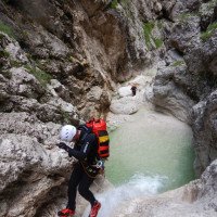
Very nice entertaining canyon in the typical vertical alpine terrain of the Julian Alps. The soft limestone in this area leads to a beautiful mountain and canyon ambience. White limestone and blue pools and 19 well-equipped rappelling points make the canyon a delight for lovers of alpine canyons. In parts, Torto can become quite challenging when the water level is higher, as some rappelling points are compulsory in bundled water. Due to the soft rock and the rather low frequency of the Rio Torto, the emergency drill kit should always be present.
Sud
Sintesi:
traduzione alternativa
➜
Lingua originale
Sehr schöne kurzweilige Schlucht im typischen vertikalen alpinen Gelände der julischen Alpen. Der weiche Kalk in diesem Gebiet führt zu einem wunderschönen Berg- und Schluchtambiente. Weißer Kalk und blaue Gumpen und 19 gut eingerichtete Abseilstellen machen die Schlucht für Freunde von alpinen Schluchten zum Genuss. Teilweise kann der Torto durchaus herausfordernd werden wenn der Wasserstand höher ist, da einige Abseilstellen zwingend im gebündelten Wasser verlaufen. Auf Grund des weichen Gesteins und durch die eher geringe Begehungsfrequenz des Rio Tortos, sollte immer das Notbohrset dabei sein.
Very nice entertaining canyon in the typical vertical alpine terrain of the Julian Alps. The soft limestone in this area leads to a beautiful mountain and canyon ambience. White limestone and blue pools and 19 well-equipped rappelling points make the canyon a delight for lovers of alpine canyons. In parts, Torto can become quite challenging when the water level is higher, as some rappelling points are compulsory in bundled water. Due to the soft rock and the rather low frequency of the Rio Torto, the emergency drill kit should always be present.
Accesso:
traduzione alternativa
➜
Lingua originale
Von Österreich kommend über den Grenzübergang Arnoldstein und die A23 folgen bis zur Ausfahrt Tarvisio, wo man die A23 verlässt. Danach biegt man links ab und fährt über die Brücke des Flusses „Slizza. Nach ca 200m biegt man rechts ab in Richtung „Bovec“. Nach ca 250m kommt erneut zu einer Brücke über den „Slizza“ nach der Brück hält man sich links in Richtung „Bovec“. Nach ca 600m kommt man zum nächsten Stoppschild, wo man erneut links abbiegt in Richtung „Bovec“. Auf dieser Straße (SS54) bleibt man für 9,1km ehe man dann ca 1km nach der Ortschaft „Cave del Predil“ rechts auf die SP76 in Richtung „Sella Nevea“ abbiegt. Auf der SP76 bleibt man für 5,1km – fährt am „Lago del Predil“ vorbei immer in Richtung Sella Nevea. Nach 5,1km biegt man rechts ab in den Parkplatz direkt vor der Brücke über den Rio Torto. Hier die Autos parken (N46.402400, E13.519200)
Mit dem Überstellungsfahrzeug, das idealerweise geländegängig ist oder einen geländegängigen Fahrer hat ;-) biegt man rechts über die Brücke des Rio Torto ab und folgt der SP76 weiter in Richtung Sella Nevea. Nach 900m kommt rechts ein Denkmal (Stein mit Kreuz) in der man auf die Schotterstraße abbiegt. Die Schotterstraße mit teilweisen tiefen Schlaglöchern und steilen Spitzkehren führt 4km bergauf bis man auf der Alm „Malta Grantagar“ ankommt. Die Straße hat zwar unten einen Schranken mit Fahrverbotsschild, jedoch ist es ok wenn man mit dem Auto bis zur Alm fährt, wenn man dann oben auf der Alm auch etwas konsumiert (dies ist auch extrem empfehlenswert, sensationelles Essen und sehr nette Wirtsleute). Parkplatz oben bei (N46.414611, E13.504021)
ACHTUNG: auf Grund der Beliebtheit des Gebiets und der beschränkten Parkplätze sollten wirklich nur so wenig Fahrzeuge wie möglich auf die Alm fahren.
Coming from Austria, cross the border at Arnoldstein and follow the A23 until the Tarvisio exit, where you leave the A23. Then turn left and drive over the bridge of the river "Slizza. After about 200m turn right in the direction of "Bovec". After about 250m you will come to another bridge over the river "Slizza". After the bridge turn left in the direction of "Bovec". After about 600m you come to the next stop sign, where you turn left again in the direction of "Bovec". Stay on this road (SS54) for 9.1km before turning right onto the SP76 towards "Sella Nevea" about 1km after the village of "Cave del Predil". Stay on the SP76 for 5,1km - pass the "Lago del Predil" always in the direction of "Sella Nevea". After 5.1km turn right into the parking lot just before the bridge over the Rio Torto. Here park the cars (N46.402400, E13.519200)
With the shuttle car, which should ideally be all-terrain or have an all-terrain driver ;-), turn right over the bridge of the Rio Torto and continue along the SP76 in the direction of Sella Nevea. After 900m there is a monument on the right (stone with a cross) where you turn onto the gravel road. The dirt road with deep potholes and steep hairpin bends goes uphill for 4km until you reach the alpine pasture "Malta Grantagar". The road has a barrier with a no driving sign at the bottom, but it is ok to drive up to the mountain pasture if you then also consume something at the top of the mountain pasture (this is also extremely recommendable, sensational food and very nice innkeepers). Parking at the top at (N46.414611, E13.504021)
ATTENTION: due to the popularity of the area and the limited parking, really only as few vehicles as possible should drive up to the Alm.
Avvicinamento (0 min):
traduzione alternativa
➜
Lingua originale
Direkt bei der Talstation der Materialseilbahn für die Corsihütte beginnt der Weg 628a. Weg-Hinweisschild „Rifugio Corsi“ dem Weg zuerst leicht bergab und dann für ca 15min bergauf folgen. Der Einstieg befindet sich direkt dort, wo das erste mit Stahlseilen versicherte Stück beginnt (Einzelner Ringbohrhaken bei den Ankerpunkten des Drahtseils).
Wer sich den 2021 erstbegangenen oberen Teil ersparen will geht den gleichen Weg bergab und zweigt dann bei einem Nebenarm des Torto gleich in die Schlucht ab. (5 min)
Trail 628a begins directly at the valley station of the material cable car for the Corsi Hut. Follow the trail sign "Rifugio Corsi" first slightly downhill and then uphill for about 15min. The entry is directly where the first section secured with steel cables begins (single ring bolt at the anchor points of the wire rope).
If you want to avoid the upper part, which was first climbed in 2021, go down the same way and then branch off into the canyons at a branch of the Torto. (5 min)
Giro (0 min):
traduzione alternativa
➜
Lingua originale
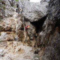
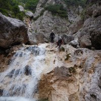
Vom Einzelbohrhaken am Drahtseil, kann man sich entweder ca 20m in die Schlucht abseilen oder man klettert ab, bis man ins Bachbett kommt. Nach ca 250 Geh- und Abgkletterpassage quert man links auf ein Felsband von dem man sich von einem Einzelbohrhaken in den engeren Teil der Schlucht abseilt. Der obere Teil besteht aus 5 Stufen mit bis zu 15m die ohne viel Gehstrecke aufeinander folgen und durchaus schön sind.
Nach einem Zufluss der von rechts in die Schlucht kommt folgt eine offene Gehstrecke für ca 15 min (das ist der Bereich wo man auch in die Schlucht kommt wenn man direkt bei der Materialseilbahn in den Torto einsteigt und den oberen Teil auslässt.)
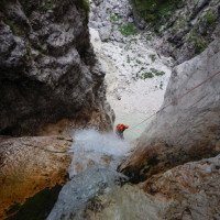
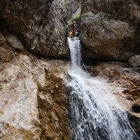
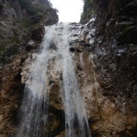
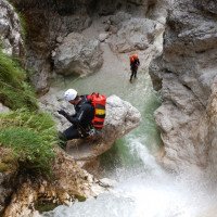
Nach einem kleinen Abseiler von einem Stein (R8 re) folgen einige schöne Abseilstellen, die teilweise direkt im Wasser absolviert werden müssen. Beim C27re gibt es sogar Bohrhaken (re), die man als Umlenker verwenden kann will man das Wasser vermeiden. Hier beginnt auch ein etwas eingeschnittener Teil, der nach 3 weiteren Abseilstellen wieder endet. Nach einem weiteren Zufluss von links und einer Gehstrecke kommt man zum höchsten Abseiler (C33 li).
Nach weiteren 5 Abseilstellen endet dann Schlucht mit einer ca 500m Gehstrecke wo man dann or li direkt beim unteren Parkplatz an der Brücke ankommt.
From the single piton on the wire rope, you can either rappel about 20m into the canyon or rappel down until you reach the streambed. After about 250 walking and rappelling passages, you cross to the left onto a rocky ledge from which you rappel from a single piton into the narrower part of the canyon. The upper part consists of 5 steps with up to 15m that follow each other without much walking passages and are quite beautiful.
After a tributary that comes into the canyon from the right, there is an open walking passages for about 15 min (this is the area where you also enter the canyon if you enter Torto directly at the material cableway and skip the upper part).
After a small rappel from a rock (R8 re) some nice rappels follow, some of which have to be done directly in the water. At the C27re there are even bolts (right), which can be used as a redirect if you want to avoid the water. Here also begins a somewhat cut part, which ends again after 3 more rappels. After another inflow from the left and a walking passages you come to the highest rappel (C33 left).
After another 5 rappels, the canyon ends with a 500m walking passages where you arrive or left directly at the lower parking lot at the bridge.
Ritorno (0 min):
traduzione alternativa
➜
Lingua originale
Bei den Trittspuren orogr. li raus und durch den Wald oder direkt bis zur Brücke im offenen Bachbett.
At the footprints or li out and through the forest or directly to the bridge in the open streambed.
Coordinate:
Inizio del canyon
Parcheggio Entrata e uscita
Parkplatz bei Brücke über den Rio Torto
Fine del canyon
Info sul canyon ACA
Info sul canyon Cwiki
Info sul canyon Descente
09.03.2023
System User
⭐
★★★★★
📖
★★★
⚓
★★★
nessuna traduzione disponibile
Info: Teile der Canyonbeschreibung wurden automatisiert übernommen. Konkret die Felder Weblinks, Koordinaten, Rating, Ort, Länge des Canyon, Einfachseil Mindestens von https://canyon.carto.net/cwiki/bin/view/Canyons/RioTortoCanyon.html und https://www.descente-canyon.com/canyoning/canyon/23761
09.03.2023
System User
⭐
★★★★★
📖
★★★
⚓
★★★
nessuna traduzione disponibile
Daten importiert von https://www.canyoning.or.at/index.php/liste-aller-canyons/552-rio-torto
Idrologia:
