v4 a3 IV
3h10
30min
2h30
10min
990m
900m
90m
17m
1x25m+1x20m
8
130m
a piedi
Valutazione:
★★★★★
3.2 (3)
Info:
★★★
2 (2)
Belay:
★★★
1.5 (2)
Sintesi:
traduzione alternativa
➜
Lingua originale
Kurzer, aber sportlich attraktiver Abseilcanyon
Short but sporty attractive rappel canyon
Est
Sintesi:
traduzione alternativa
➜
Lingua originale
Kurzer, aber sportlich attraktiver Abseilcanyon
Short but sporty attractive rappel canyon
Accesso:
traduzione alternativa
➜
Lingua originale
Wir verlassen die A8 (Luzern-Interlaken) über die Ausfahrt Sarnen-Nord. Über Kerns fahren wir in's Melchtal. Wir durchfahren die gleichnamige Ortschaft und biegen etwa 550m nach dem Ortskern halbrechts ab. Nach weiteren 300m kommen wir zu einer Haarnadelkurve nach rechts. In der Kurve biegen wir nach Süden ab und kommen schnell zu einem Picnicplatz. Hier können wir unser Auto abstellen.
We leave the A8 (Lucerne-Interlaken) via the exit Sarnen-Nord. Via Kerns we drive into Melchtal. We drive through the village of the same name and turn half-right about 550m after the village center. After another 300m we come to a hairpin bend to the right. In the bend we turn south and quickly come to a picnic area. Here we can park our car.
Avvicinamento (30 min):
traduzione alternativa
➜
Lingua originale
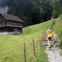
Wir gehen zurück bis zur Haarnadelkurve und dann links, hinunter zur Brücke über die Melcha. Auf der anderen Seite nehmen wir den Weg zu den Wasserfällen. Er zieht vom Bach weg und aufwärts. Wir kommen zu einer Wiese und einem Haus hier ziehen wir am Rand der Wiese rechts abwärts und setzen unseren Weg am Nordende der Wiese höhengleich in den Wald fort. Wir kletter hinab an den Schluchtrand und seilen dann die letzten (ca. 15m) von einem Baum in die Schlucht hinein.
We go back to the hairpin bend and then left, down to the bridge over the Melcha. On the other side we take the path to the waterfalls. It moves away from the stream and up. We come to a meadow and a house here we move downhill to the right at the edge of the meadow and continue our path at the north end of the meadow at the same level into the forest. We climb down to the canyon rim and then rope the last (about 15m) from a tree into the canyon.
Giro (2 h 30):
traduzione alternativa
➜
Lingua originale
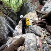
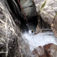
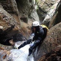
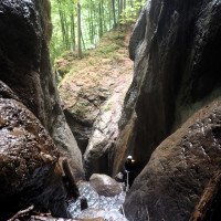
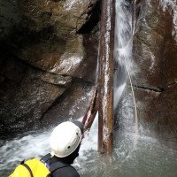
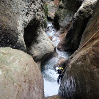
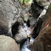
6-8 Abseiler, wobei man wiederholt über mehrere Stufen abseilt.
Notausstiege sind keine vorhanden. Es ist möglich an ein oder zwei Stellen aus dem Wasser zu kommen. Eine Stelle könnte zum Notausstieg genutzt werden rechtsseitig. Hier müsste man aber zwei Haken Bohren für ein Seilgeländer.
6-8 rappel, repeatedly rappelling over several steps.
There are no emergency exits. It is possible to get out of the water in one or two places. One place could be used for emergency exit on the right side. But here you would have to drill two anchors for a rope traverse.
Ritorno (10 min):
traduzione alternativa
➜
Lingua originale
Am Schluchtende rechts hinaus auf den Anmarschweg und zum Auto.
At the canyon exit, turn right out onto the approach trail and to the car.
Coordinate:
Inizio del canyon
46.827°, 8.28256°
↓↑
DMS: 46° 49" 37.2', 8° 16" 57.22'
DM: 46° 49.62", 8° 16.954"
Google Maps
Svizzera Topografica
DMS: 46° 49" 37.2', 8° 16" 57.22'
DM: 46° 49.62", 8° 16.954"
Google Maps
Svizzera Topografica
l\'entrée en 985m alt. (descente) // cwiki
Fine del canyon
46.8273°, 8.2841°
↓↑
DMS: 46° 49" 38.28', 8° 17" 2.76'
DM: 46° 49.638", 8° 17.046"
Google Maps
Svizzera Topografica
DMS: 46° 49" 38.28', 8° 17" 2.76'
DM: 46° 49.638", 8° 17.046"
Google Maps
Svizzera Topografica
Partenza alternativa del canyon
46.8267°, 8.27773°
↓↑
DMS: 46° 49" 36.12', 8° 16" 39.83'
DM: 46° 49.602", 8° 16.664"
Google Maps
Svizzera Topografica
DMS: 46° 49" 36.12', 8° 16" 39.83'
DM: 46° 49.602", 8° 16.664"
Google Maps
Svizzera Topografica
(descente_1)
Parcheggio Entrata e uscita
46.8262°, 8.28597°
↓↑
DMS: 46° 49" 34.32', 8° 17" 9.49'
DM: 46° 49.572", 8° 17.158"
Google Maps
Svizzera Topografica
DMS: 46° 49" 34.32', 8° 17" 9.49'
DM: 46° 49.572", 8° 17.158"
Google Maps
Svizzera Topografica
place de picnic (descente)
Letteratura:
Mappa
1:25000
Libro Canyoning
Emmanuel Belut / Laurence Boyé / Thomas Guigon
Association Openbach
2015
9782746679450
Info sul canyon Cwiki
Info sul canyon Descente
Info sul canyon Ropewiki
Info sul canyon Schlucht.ch
31.08.2024
Juan Montesinos
⭐
★★★★★
📖
★★★
⚓
★★★
💧
Basso
Completato ✔
traduzione alternativa
➜
Lingua originale
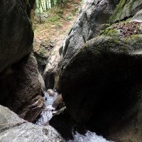
Caudal normal-bajo (ver foto de referencia).
Varios anclajes estaban flojos y han sido reajustados. Nuevo anclaje añadido en R5. Recomiendo llevar por lo menos una llave para apretar los anclajes.
Hay bastantes troncos y ramas. Por lo demás Todo bien.
Normal-low flow (see reference photo).
Several anchors were loose and have been readjusted. New anchor added at R5. I recommend carrying at least one wrench to tighten the anchors.
There are quite a few logs and branches. Otherwise all good.
08.06.2023
Daniel Sturm
⭐
★★★★★
📖
★★★
⚓
★★★
💧
Normale
Completato ✔
traduzione alternativa
➜
Lingua originale
Reiner Abseilanyon, recht kurz. Unerwartet eingeschnitten und landschaftlich schön.
Gegen Ende wegloser Zustieg, immer unterhalb der Weide bleiben.
Aktuell einige Verklausungen.
Haken alle okay, einer etwas lose. Maximal 1 Haken.
Pure abseil canyon, quite short. Unexpectedly cut and scenic.
Towards the end pathless approach, always stay below the pasture.
Currently, some cloying.
Hooks all okay, one a bit loose. Maximum 1 hook.
09.03.2023
System User
⭐
★★★★★
📖
★★★
⚓
★★★
nessuna traduzione disponibile
Info: Teile der Canyonbeschreibung wurden automatisiert übernommen. Konkret die Felder Weblinks, Koordinaten, Rating, Länge des Canyon, Einfachseil Mindestens von https://www.descente-canyon.com/canyoning/canyon/22866
09.03.2023
System User
⭐
★★★★★
📖
★★★
⚓
★★★
nessuna traduzione disponibile
Daten importiert von https://canyon.carto.net/cwiki/bin/view/Canyons/TummlibachCanyon.html
Nuovo rapporto
Riportare brevemente e concisamente le informazioni più importanti dell'ultimo tour o importanti informazioni attuali sul canyon. Se necessario con link a video, foto, ecc..
*
*
*
Esc
Del
Idrologia:


