un po' difficile
Valle della Grigna
v4 a4 III
4h10
30min
3h30
10min
710m
490m
220m
45m
2x 50m
Auto necessaria
Valutazione:
★★★★★
2.9 (1)
Info:
★★★
0 ()
Belay:
★★★
0 ()
Sintesi:
traduzione alternativa
➜
Lingua originale
Zu Beginn eine Sukzession von Abseilern, dann Wander- und Schwimm-Canyon mit Abseilern.
At the beginning a succession of rappels, then hiking and swimming canyon with rappels.
Sintesi:
traduzione alternativa
➜
Lingua originale
Zu Beginn eine Sukzession von Abseilern, dann Wander- und Schwimm-Canyon mit Abseilern.
At the beginning a succession of rappels, then hiking and swimming canyon with rappels.
Accesso:
traduzione alternativa
➜
Lingua originale
Die Autostrada A 4 (Milano-Brescia) zwischen Bergamo und Brescia über die Ausfahrt Ospidaletto verlassen und nordwärts über die SS 10 zum Lago d'Iseo. An dessen Ostufer entlang weiter auf der SS 42 das Val Camonica aufwärts bis Esine. Dort abbiegen und nach Bienno hinauf. Von da weiter auf der Hauptstraße in Serpentinen hinauf und nach der Ersten auf der Via Ponte Prada rechts ab zum Friedhof (Ortsteil Isola). Weiter auf dem engen Sträßchen und auf einer Brücke über einen rechten Seitenbach des Grigna. Direkt nach der Brücke rechts auf der Via Isola in Richtung E-Werk. Bei den ersten Parkplätzen links das untere Auto abstellen.\nMit dem zweiten Fahrzeug zurück zur Brücke, aber nicht hinüber, sondern vor der Brücke rechts aufwärts (Via Ponte Prada), durchfährt ein kleines Gewerbegebiet und biegt dann rechts ab auf ein kleines Teersträßchen in Richtung Novali. Steil geht es hinauf, bis man eine größere freie vFläche rechts der Straße (in einem Linksbogen) erreicht (Höhe ca. 850m üNN). Hier das zweite Auto abstellen.
Leave the A 4 autostrada (Milano-Brescia) between Bergamo and Brescia at the Ospidaletto exit and head north on the SS 10 to Lago d'Iseo. Continue along the eastern shore of the lake on the SS 42 up the Val Camonica to Esine. Turn off there and drive up to Bienno. From there, continue on the main road up the hairpin bends and after the first one on Via Ponte Prada turn right to the cemetery (Isola district). Continue along the narrow road and cross a bridge over a right-hand side stream of the Grigna. Immediately after the bridge, turn right onto Via Isola in the direction of E-Werk. Park the lower car at the first parking spaces on the left.\nWith the second car, return to the bridge, but do not cross it, but turn right uphill before the bridge (Via Ponte Prada), drive through a small industrial area and then turn right onto a small tarred road in the direction of Novali. The road climbs steeply until you reach a large open area to the right of the road (in a left-hand bend) (altitude approx. 850m above sea level). Park the second car here.
Avvicinamento (30 min):
traduzione alternativa
➜
Lingua originale
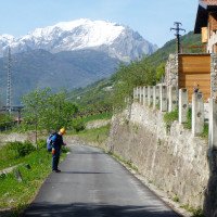
Vom oberen Auto auf einem Pfad im Zickzack direkt in Richtung Grigna hinunter, vorbei an einem Ziegenstall (zur Rechten).\nP. v. Duin will nach etwa 50 m über die Mulde nach links queren auf einen kleinen leicht aufwärts führenden Pfad und dann hinunter zum Grigna (vgl. dortige Beschreibung).\nWir gingen dagegen weiter direkt abwärts und erreichten einen Querpfad mit einem Markierungssteinhaufen. Der horizontal verlaufende Pfad könnte nach links zum Einstieg führen, war aber völlig zugewachsen. Also weiter hinunter bis zum einem kleinen Plateau über der Grigna. Hier die Spur nach links suchen und über das zum Fluss hinabziehende Kar hinweg leicht bergan auf einen Rücken und dort jenseits hinab zum Einstieg. Wir sind irrig das besagte Kar rechts hinunter und kamen zum Grigna leider direkt unterhalb der attraktiven Einstiegswasserfälle.
From the upper car, zigzag down a path directly towards Grigna, past a goat shed (on the right).\nP. v. Duin wants to cross the hollow to the left after about 50 m onto a small path leading slightly uphill and then down to Grigna (see description there).\nWe, on the other hand, continued directly downhill and reached a cross-path with a pile of marker stones. The horizontal path could have led to the entry on the left, but was completely overgrown. So we continued down to a small plateau above the Grigna. Look for the tracks to the left here and across the cirque leading down to the river, slightly uphill onto a ridge and then down to the entry point on the other side. We went down the aforementioned cirque to the right and unfortunately came to the Grigna directly below the attractive entry waterfalls.
Giro (3 h 30):
traduzione alternativa
➜
Lingua originale
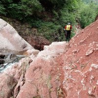
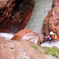
Zu Beginn eine Abfolge längerer Abseiler, meist "im Strahl". Dann wechseln Schwimm- und Laufstrecken, unterbrochen durch den ein oder anderen Abseiler. Auch einige Rutschen und Sprünge möglich. Attraktives Ambiente in rotem Gestein.
At the beginning a sequence of longer rappels, mostly "in the beam". Then swim and run sections alternate, interrupted by the odd rappel. Some slides and jumps are also possible. Attractive ambience in red rock.
Ritorno (10 min):
traduzione alternativa
➜
Lingua originale
Nach dem E-Werk noch etwa 200 m weiter im Flussbett und dann rechts hinauf zur Via Isola und auf dieser Straße zum unteren Auto. \nMöglichkeit eines Ausstiegs vor der engeren Schlusspassage links den Hang hinauf an einem Fixseil (Mai 2012).
After the power station, continue along the river bed for about 200 m and then turn right up to Via Isola and on this road to the lower car. \nPossibility of an exit before the narrower final passage to the left up the slope on a fixed rope (May 2012).
Coordinate:
Inizio del canyon
Fine del canyon
Letteratura:
Mappa
Kompass WK 103, Tre Valli Bresciane, 1:50 000
Mappa
edizione multigrafic Prealpi lombarde, Val Camonica, Presolana, 1 : 25 000
Info sul canyon Cwiki
Gallería
Altro info sul canyon
Info sul canyon Ropewiki
09.03.2023
System User
⭐
★★★★★
📖
★★★
⚓
★★★
nessuna traduzione disponibile
Daten importiert von https://canyon.carto.net/cwiki/bin/view/Canyons/ValledellaGrignaCanyon.html
Idrologia:


