un po' difficile
Bogutovski Potok
v4 a3 III
3h15
30min
2h30
15min
350m
120m
230m
30m
2x40m (2x30m)
11
Auto necessaria
Valutazione:
★★★★★
3.6 (4)
Info:
★★★
1 (1)
Belay:
★★★
2.5 (2)
Sintesi:
traduzione alternativa
➜
Lingua originale
Schöne vegetationsreiche und Wasserführende Schlucht; erster Teil offen, zweiter Teil eingeschnitten; Fluchtmöglichkeiten
im ersten Teil bzw. vor dem 30m Schlußwasserfall links; Absicherungen sind schon etwas älter jedoch ausreichend; längere
Autoüberstellung; schöne Aushöhlungen, Versinterungen und Stalaktiten im zweiten Teil; kaltes Wasser; großes
Einzugsgebiet.
Beautiful vegetated and water-bearing canyon; first part open, second part cut; escape possibilities
in the first part or before the 30m final waterfall on the left; belays are already a bit older but sufficient; longer
car overpass; beautiful cavities, sintering and stalactites in the second part; cold water; large catchment
catchment area.
Accesso:
traduzione alternativa
➜
Lingua originale
Von Podgorica Richtung Norden (Kolašin) entlang der Morača. Direkt nach dem 9. Tunnel (9. Tunnel = ganz kurz) wird bei Km 1012 rechts bei der Ausweiche das Überstellungsfahrzeug geparkt. Mit dem 2. PKW fährt man ein kurzes Stück Richtung Norden. Nach der Ortschaftstafel Trmanje direkt nach der Brücke biegt man in die kleine unscheinbare Ausfahrt links ab. Man folgt der schmalen Bergstraße 5Km. Dann biegt man links in eine Fortstraße ab(Bodenfreiheit PKW!). Der Forststraße folgt man rechtshaltend bis zu einer offenen Fläche (kleine Holzhütte).
approx. parking exit 40min/ parking entry 1h10min
From Podgorica direction north (Kolašin) along the Morača. Directly after the 9th tunnel (9th tunnel = very short) the shuttle car is parked on the right at the turnout at Km 1012. With the 2nd car you drive a short distance to the north. After the village sign Trmanje directly after the bridge one turns left into the small inconspicuous exit. Follow the narrow mountain road for 5 km. Then you turn left into a forest road (ground clearance for cars!). Follow the forest road to the right until you reach an open area (small wooden hut).
Avvicinamento (30 min):
traduzione alternativa
➜
Lingua originale
Vom Parkplatz folgt man der Forststraße wieder kurz zurück und weiter abwärts bis zum Bach. Ab hier folgt man den Weg/ Bachverlauf links weiter. Nach mehrmaligen überqueren des Baches trifft man auf ein altes verwachsenes Mühlenhaus auf ca. 350m. Hier ist auch der Einstieg.
approx. 30min
From the parking lot, follow the forest road back briefly and continue downhill to the stream. From here, follow the path/stream to the left. After crossing the stream several times, you will come across an old overgrown mill house at about 350m. This is also the entry point.
Giro (2 h 30):
traduzione alternativa
➜
Lingua originale
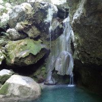
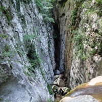
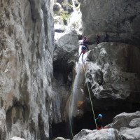
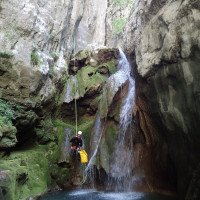
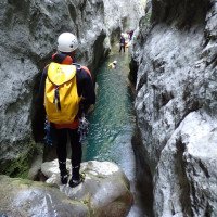
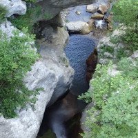
Die Bogutovski Potok ist eine schöne vegetationsreiche Schlucht mit überwiegend kürzeren Abseilstellen. Der erste Abschnitt ist noch offen. Hier können auch einige Stufen abgeklettert/ umgangen werden. Nach der ersten höheren ca. 25m Abseilstelle blickt man schon in eine tief eingeschnittene Schlucht. Hier beginnt auch der schönste Teil der Canyoningtour. Mehrere kurze Abseilstellen mit kleinen Sprungmöglichkeiten führen durch die zum Teil mit Versinterungen geschmückte Engklamm. Kurz vor der Brücke auf ca. 170m kann die Schlucht links verlassen werden oder man entscheidet sich für den letzen und höchsten ca. 30m Abseiler im Wasserlauf unter der Brücke. Der letzte Abseiler endet in der Morača auf ca. 120m.
ca. 2,5h
Bogutovski Potok is a beautiful canyon rich in vegetation with mostly shorter rappels. The first part is still open. Here some steps can be downclimbed/ bypassed. After the first higher rappelling point (about 25m) you can already see into a deep canyon. Here begins the most beautiful part of the canyoning tour. Several short abseils with possible jumps lead through the gorge, which is partly decorated with sintering. Shortly before the bridge at approx. 170m you can leave the canyon to the left or you can choose the last and highest rappel of approx. 30m in the water course under the bridge. The last rappel ends in the Morača at about 120m.
Ritorno (15 min):
traduzione alternativa
➜
Lingua originale
Erste Ausstiegsmöglichkeit: vor der Brücke auf ca. 170m links aussteigen.
Zweite Ausstiegsmöglichkeit: nach dem 30m Abseiler auf ca. 120m folgt man den Fluss auf der rechten Seite für ca. 100m. Hier führt ein kleiner unscheinbarer steiler Weg direkt zur Straße hoch (Tunnel mit Km. Begrenzung). In Kürze steht man am Ausgangsparkplatz.
approx. 15min
First exit possibility: before the bridge on the left at about 170m.
Second exit: after the 30m rappel at approx. 120m, follow the river on the right for approx. 100m. Here a small inconspicuous steep path leads directly up to the road (tunnel with Km. limit). In a short time you are at the exit parking lot.
Coordinate:
Inizio del canyon
(cwiki_1)
Parcheggio in uscita
Ausstieg Parkplatz (cwiki)
Parcheggio all'entrata
Einstieg Parkplatz (cwiki)
Fine del canyon
(cwiki_1)
Punto di passaggio
42.684037°, 19.358394°
↓↑
DMS: 42° 41" 2.53', 19° 21" 30.22'
DM: 42° 41.042", 19° 21.504"
Google Maps
DMS: 42° 41" 2.53', 19° 21" 30.22'
DM: 42° 41.042", 19° 21.504"
Google Maps
Bei der letzten Haarnadel vor dem Bach unbedingt links die Piste hinunterlaufen.
Info sul canyon ACA
Info sul canyon Cwiki
Info sul canyon Descente
Info sul canyon Ropewiki
Sconosciuto
03.08.2024
Marosffy Dániel
⭐
★★★★★
📖
★★★
⚓
★★★
💧
Basso
Completato ✔
nessuna traduzione disponibile
The first third is a struggle, 1h walk in the almost dry stream bed, luckily not that overgrown as expected. Beware of snakes, there were a lot, some looking wicked. The second third is a nice, shady forest, but still dry. Then comes the canyon, cold water enters suddenly, even some - literally - cool jumps are possible. Here you definitely need the wetsuite. The travertine formations are amazing. Exit option before the last 2 rappels (at the bridge) is quite obvious. If done till the Moraca a bit of free climb is required (15-20m, easy).
However, the rating here is misleading: no V4 but V2 instead (all rappels are simple). And we spent 4h the canyon, with decent pace, can't imagine that in the stated 2:30h.
10.07.2024
Bina
⭐
★★★★★
📖
★★★
⚓
★★★
💧
Basso
Completato ✔
nessuna traduzione disponibile
Automatisch importiert von Descente-Canyon.com für Canyon Bogutovski
(Quelle: https://www.descente-canyon.com/canyoning/canyon-debit/22179/observations.html)
10.07.2024
Bina
⭐
★★★★★
📖
★★★
⚓
★★★
💧
Basso
Completato ✔
traduzione alternativa
➜
Lingua originale
Altri utenti sono stati: Patrik Bartel
Oberer Parkplatz ist da, wo die Zick-Zack-Piste losgeht (der Anfang wäre noch bis zur 1. Haarnadel fahrbar, danach aber nicht mehr). Bei der letzten Haarnadel vor dem Bach unbedingt links die Piste hinunterlaufen. Danach kann man mal links, mal rechts einem kleinen Pfad, der schon etwas zugewachsen und dornig ist (Neopren unten rum schon anziehen) folgen, bis man lieber bachwandert als weiter durchs Gestrüpp gehen (45Min. ab Strasse). Man muss etwas Geduld haben, denn die Schlucht wird erst schön, da, wo sie tief eingeschnitten ist, dann aber bis zum Schluss sehr schön.
The upper parking lot is where the zig-zag slope starts (the beginning would still be rideable up to the 1st hairpin, but not after that). At the last hairpin before the stream, be sure to turn left down the slope. Then you can follow a small path, sometimes left, sometimes right, which is already somewhat overgrown and thorny (wear neoprene at the bottom), until you prefer to walk along the stream rather than continue through the undergrowth (45 minutes from the road). You have to be patient, because the canyon only becomes beautiful where it is cut deep, but then it is very beautiful until the end.
Altri utenti sono stati: Patrik Bartel
09.03.2023
System User
⭐
★★★★★
📖
★★★
⚓
★★★
nessuna traduzione disponibile
Info: Teile der Canyonbeschreibung wurden automatisiert übernommen. Konkret die Felder Weblinks, Koordinaten, Rating, Ort von https://canyon.carto.net/cwiki/bin/view/Canyons/BogutovskiPotokCanyon.html
09.03.2023
System User
⭐
★★★★★
📖
★★★
⚓
★★★
nessuna traduzione disponibile
Daten importiert von https://www.canyoning.or.at/index.php/liste-aller-canyons/415-bugotovski-potok
Nuovo rapporto
Riportare brevemente e concisamente le informazioni più importanti dell'ultimo tour o importanti informazioni attuali sul canyon. Se necessario con link a video, foto, ecc..
*
*
*
Esc
Del
Idrologia:

