difficile
Sulzlbach
v3 a5 III
4h30
1h
3h15
15min
1280m
1100m
180m
25m
2x40m
16
1700m
a piedi
Valutazione:
★★★★★
3.2 (3)
Info:
★★★
2 (1)
Belay:
★★★
3 (1)
Sintesi:
traduzione alternativa
➜
Lingua originale
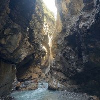
Sehr schöne, aquatische und technisch anspruchsvolle Schlucht; gut eingerichtet; drei Notausstiege im unteren Teil; mehrere Becken mit starker Strömung und Unterspülungen; auch mit kleinen Rückläufigen Gumpen ist zu rechnen; großes Einzugsgebiet (15Km2); keine Anfängertour! Evtl. einige Stufen rutschbar/springbar; Zustieg durch Steintunnel mit schöner Aussicht.
Very beautiful, aquatic and technically demanding canyon; well equipped; three emergency exits in the lower part; several pools with strong currents and undercutting; also with small returning pools is to be expected; large catchment area (15Km2); no beginner tour! Possibly some steps slidable / jumpable; access through stone tunnel with beautiful views.
Nord
Sintesi:
traduzione alternativa
➜
Lingua originale
Sehr schöne, aquatische und technisch anspruchsvolle Schlucht; gut eingerichtet; drei Notausstiege im unteren Teil; mehrere Becken mit starker Strömung und Unterspülungen; auch mit kleinen Rückläufigen Gumpen ist zu rechnen; großes Einzugsgebiet (15Km2); keine Anfängertour! Evtl. einige Stufen rutschbar/springbar; Zustieg durch Steintunnel mit schöner Aussicht.
Very beautiful, aquatic and technically demanding canyon; well equipped; three emergency exits in the lower part; several pools with strong currents and undercutting; also with small returning pools is to be expected; large catchment area (15Km2); no beginner tour! Possibly some steps slidable / jumpable; access through stone tunnel with beautiful views.
Accesso:
traduzione alternativa
➜
Lingua originale
Von Reutte in südlicher Richtung bis zur Ortschaft Stockach fahren. Vor der Brücke (Tankstelle) gibt es auf der rechten und linken Straßenseite einen großen Schotterparkplatz wo auch übernachtet werden kann (parken1 Tag €3,-, Übernachtung €10,-, Stand 2022). Entweder man parkt hier den PKW oder man fährt links in Richtung Sulzlbach hoch, kurz über die Brücke und links weiter bis zum letzten Haus (alte Jugendherberge) neben dem Sulzlbach. Hier haben ca. 10 PKW Platz.
40min
From Reutte drive in southern direction to the village Stockach. Before the bridge (gas station) there is a large gravel parking place on the right and left side of the road where you can also stay overnight (parking1 day €3,-, overnight €10,-, as of 2022). Either you park your car here or you drive up to the left in the direction of Sulzlbach, briefly over the bridge and left to the last house (old youth hostel) next to the Sulzlbach. There is room for about 10 cars here.
Avvicinamento (1 h):
traduzione alternativa
➜
Lingua originale
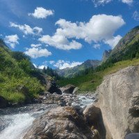
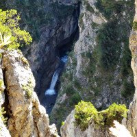
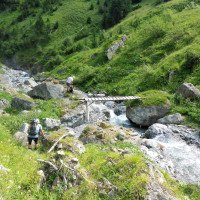
Direkt bei der alten Jugendherberge kann vor der Tour im Bach abgestiegen werden um dann Bachaufwärts nach 10min den Wasserstand bei der letzten hohen 25m + 8m Kaskade zu checken. Nach der Kontrolle geht es am besten über die Forststraße direkt neben der Jugendherberge (Wanderbeschilderung "Stierboden, Sulzlbachalm") hoch. Nach den aussichtsreichen Tunnellöcher geht man weiter bis zum Holzkreuz. Hier gleich links auf einen Kuhpfad bis zum Bach (kleine Holzbrücke) auf ca. 1280m absteigen.
1h
Directly at the old youth hostel can be descended before the tour in the stream to then check upstream after 10min the water level at the last high 25m + 8m cascade. After the check it is best to go up via the forest road right next to the youth hostel (hiking signs "Stierboden, Sulzlbachalm"). After the panoramic tunnel holes, continue to the wooden cross. Here, immediately turn left onto a cow path and descend to the stream (small wooden bridge) at approx. 1280m.
Giro (3 h 15):
traduzione alternativa
➜
Lingua originale
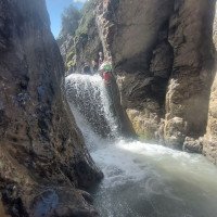
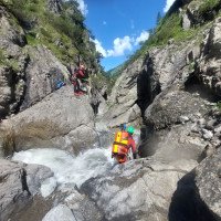
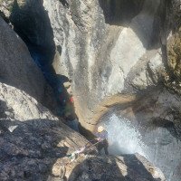
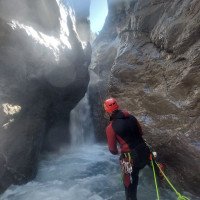
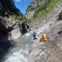
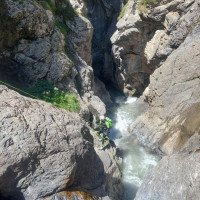
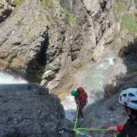
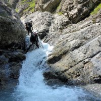
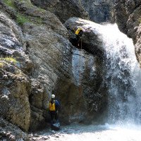
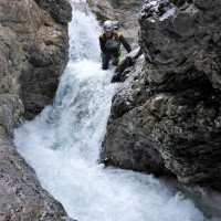
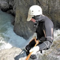
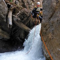
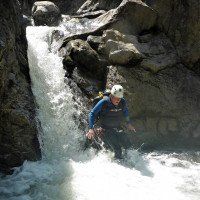
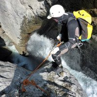
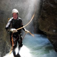
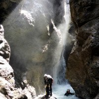
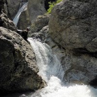
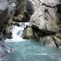
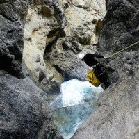
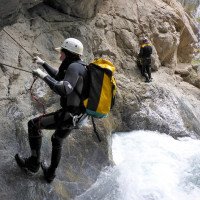
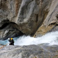
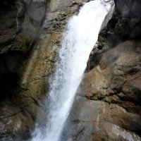
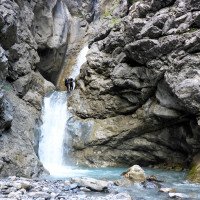
Die Tour fängt etwas unterhalb von der im Sommer bewirtschafteten Sulzlbachalm bei der kleinen Holzbrücke an. Nach einer Geh- und Abkletterstrecke (ca. 200m) kommt die erste von vielen, bis max. 10m hohen Abseilstellen, die meist ohne große Probleme gemeistert werden. Zwischen den Abseilstellen in der oberen Hälfte gib es immer wieder kurze Geh- und Abkletterpassagen. Umso weiter man Abstieg umso mehr verengt sich die Schlucht und die Schwierigkeit nimmt zu. Die Abseilstellen sind alle gut angebracht. Vorsicht und saubere Seilarbeit sind aber bei den zum Teil sehr aquatischen und strömungsreichen Becken Voraussetzung! Zwei markante 25m Abseilstellen mit großen Gumpen (1x in der Mitte und 1x am Schluss) sind die Schlüsselstellen der Tour. Hat man bei der letzten hohen Kaskade (25m+ 8m) kein gutes Gefühl, so kann über ein Fixseil und alten Wartungssteig, orographisch links zum flachen Bachbett (auf ca. 1200m) abgestiegen werden.
3-3,5h
The tour starts a bit below the Sulzlbachalm, which is open in summer, at the small wooden bridge. After a walking and descending section (approx. 200m) comes the first of many, up to max. 10m high rappelling points, which are mostly mastered without major problems. Between the abseils in the upper half there are always short walking and downclimb passages. The further you descend, the more the canyon narrows and the difficulty increases. The rappels are all well placed. However, caution and clean rope work are a prerequisite in the partly very aquatic and current-rich pools! Two prominent 25m rappels with large pools (1x in the middle and 1x at the end) are the key points of the tour. If you don't have a good feeling at the last high cascade (25m+ 8m), you can descend via a fixed rope and an old maintenance path, orographically left to the shallow streambed (at about 1200m).
Ritorno (15 min):
traduzione alternativa
➜
Lingua originale
Nach der letzten Kaskade folgt man auf ca. 1100m dem flachen Bachbett bis zur Jugendherberge (Parkplatz) zurück.
15min
After the last cascade, follow the flat streambed back to the youth hostel (parking lot) at about 1100m.
Coordinate:
Inizio del canyon
47.2404°, 10.3666°
↓↑
DMS: 47° 14" 25.44', 10° 21" 59.76'
DM: 47° 14.424", 10° 21.996"
Google Maps
Austria Topografica
DMS: 47° 14" 25.44', 10° 21" 59.76'
DM: 47° 14.424", 10° 21.996"
Google Maps
Austria Topografica
(cwiki_1)
Fine del canyon
47.2519°, 10.3661°
↓↑
DMS: 47° 15" 6.84', 10° 21" 57.96'
DM: 47° 15.114", 10° 21.966"
Google Maps
Austria Topografica
DMS: 47° 15" 6.84', 10° 21" 57.96'
DM: 47° 15.114", 10° 21.966"
Google Maps
Austria Topografica
(cwiki_1)
Letteratura:
Libro Canyoning
Werner Baumgarten
2010
Libro Canyoning
Werner Baumgarten
2013
Libro Canyoning
Alexander Riml / Gunnar Amor
2012
Info sul canyon ACA
Info sul canyon Cwiki
Info sul canyon Descente
Info sul canyon Ropewiki
15.07.2023
Patrik
⭐
★★★★★
📖
★★★
⚓
★★★
💧
Alto
Completato ✔
traduzione alternativa
➜
Lingua originale
Alle Bolts/Ketten sind gem. Topo "Tiroler Schluchtenführer" vorhanden. Beim Abseiler Nr. 7 ist bei einem hohen Wasserstand ein Rapel Guide oder Circuit Ferme von Vorteil resp. nötig (Bolts sind unten vorhanden-links) starker Rücklauf und Felsen sind unterspült. Beim Abseiler Nr. 3 ist ebenfalls ein starker Rücklauf vorhanden. Der Pool ist relativ gross (von oben nicht sichtbar) - Stahlseil als Rappel Guide benutzen oder vor das Weisswasser springen. Viel Spass....
All bolts/chains are present according to the topo "Tiroler Schluchtenführer". At abseil No. 7, a Rapel Guide or Circuit Ferme is advantageous or necessary at a high water level (bolts are present at the bottom-left), strong backflow and rocks are washed out. At rappel no. 3 there is also a strong backflow. The pool is relatively large (not visible from above) - use steel rope as rappel guide or jump in front of the white water. Have fun....
09.03.2023
System User
⭐
★★★★★
📖
★★★
⚓
★★★
nessuna traduzione disponibile
Info: Teile der Canyonbeschreibung wurden automatisiert übernommen. Konkret die Felder Weblinks, Koordinaten, Rating, Ort, Länge des Canyon, Einfachseil Mindestens von https://canyon.carto.net/cwiki/bin/view/Canyons/SulzlbachCanyon.html und https://www.descente-canyon.com/canyoning/canyon/22382
09.03.2023
System User
⭐
★★★★★
📖
★★★
⚓
★★★
nessuna traduzione disponibile
Daten importiert von https://www.canyoning.or.at/index.php/liste-aller-canyons/582-sulzlbach
Nuovo rapporto
Riportare brevemente e concisamente le informazioni più importanti dell'ultimo tour o importanti informazioni attuali sul canyon. Se necessario con link a video, foto, ecc..
*
*
*
Esc
Del
Idrologia:
